
Guidelines for the Development of Upscaling Plans
4. Technical

Based on your practical experience during the pilot/demonstration project you should summarize critical information on applied methods, equipment, needs for trained personnel and other aspects relevant for upscaled restoration. This should include critical knowledge- and resource gaps identified during the pilot and how these can be addressed during upscaling. But remember always to consider your audience – many upscaling stakeholders will just want the information on the key things you have learned, rather than detailed methods and analyses.
Examples from the SUPERB demonstration sites show how technical challenges and solutions could be communicated to a more strategic audience (Filipek et al. 2024)
Spatial prioritization - An important question for upscaling restoration is where to locate restoration actions. As noted in Section 2.4, when a large area is considered there might be several places theoretically suitable for restoration, but given land-use, landownership, ecological conditions and other relevant factors it requires spatial planning. Based on your pilot work you should have at least an overview of what factors are relevant to spatial planning. For the next step, either as part of your upscaling route-map or as a recommendation for those implementing a large-scale restoration project, conducting a multicriteria analysis (MCA) should be considered. MCA is used when there are decision challenges involving multiple and often conflicting criteria and the goal is to find the most suitable option. There is rarely a single optimal solution, and the MCA can also incorporate stakeholder’s preferences to differentiate between different solutions. The outcome of an MCA can vary between choosing one most suitable option, sorting alternatives into different categories, ranking a set of options by preference or describing the options by their impacts There are numerous MCA tools that can support prioritization among different sites (Acosta & Corral 2017).
As a part of spatial prioritization of restoration, the connectivity between sites should be considered. It is well established that fragmentation of forest landscapes may have negative effects on conservation relevant species (cf. Undin et al. 2024) and landscape connectivity is emphasized in the EU NRR as one key restoration indicator. This call for conducting landscape analysis that identify restoration sites that increase connectivity. Such tools are rapidly developing (e.g. Wang et al. 2025).
Reproductive material - If your pilot project has included tree planting, you likely have experience in selecting appropriate plant reproductive material for upscaling. However, the choice of plant reproductive material is becoming more challenging given ongoing climate change. Hence, when restoration include artificial regeneration, access to plant reproductive material suitable for future conditions is critical. Fortunately, new tools and information is now available that support selection of both tree species and provenances in relation to anticipated climate change. With the online web-tool, Seed4Forest, decision support for species and provenance selection is available for European conditions. It is a tree species recommendation application developed by compiling and consolidating tree species distribution models for current climate and different climate change scenarios, as well as incorporating existing seed provenance delineation and transfer models. Based on this tool you may be able to recommend how a larger restoration project should include consideration of future climate conditions.
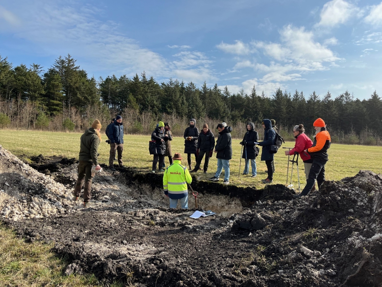
Monitoring, reporting and validation - The demo project should provide some initial evidence of the success, actual outcome, of the restoration action through an implemented monitoring system. However, for a larger restoration program, guidance on a broader monitoring and evaluation strategy should be developed. Besides to demonstrate what a project achieves; monitoring supports adaptive management and hence ensure learning by doing. This is critical for building trust and long-term commitment by funders and stakeholders. Monitoring builds on identifying indicators, response variables, that reflect the primary and any secondary restoration objectives, and with a sampling scheme that is sufficient to statistically capture trajectories over time. Within the SUPERB project several monitoring methods has been implemented and with information being available here at the Forest Knowledge Gateway. You may also consult Menéndez-Miguélez et al. (2024b) on how outcomes of forest restoration have been measured. Note however, to provide real evidence on the restoration impact, also reference areas with a corresponding initial situation should be monitored. Only through a counterfactual comparison can the true effect of implemented actions be evaluated!
Related resources
How to measure outcomes in forest restoration?
Scientific paper which analyzes 95 ecological restoration projects in Europe and identifies 84 indicators used to assess their success. It highlights five common metrics (abundance, cover, density, Ellenberg index, and richness) and emphasizes the need for harmonized indicators to evaluate restoration effectiveness, particularly under climate change. Useful for improving the planning and assessment of restoration initiatives.
- Active Restoration
- Monitoring & Projecting
- Passive Forest Restoration
- Landowners & Practitioners
- Planners & Implementers
- Policy Actors
- Afforestation, reforestation
- Non-timber products
- Restoration after direct human impact
- Restoration after natural disturbances
- Soil health
- Structural diversity
- Tree species/functional diversity
- Wood and biomass production
- Continental
- Mediterranean
- Austria
- Belgium
- Finland
- Germany
- Italy
- Portugal
- Russia
- Spain
- Switzerland
- United Kingdom

Seed4Forest
Seed4Forest is a Europe-wide decision-support tool that guides users in selecting climate-resilient tree species, species mixtures, and provenances for forest restoration and management. It integrates up-to-date scientific models—including species distribution, productivity, mixture suitability, and provenance guidance—to assess the performance of multiple species under current and future climate conditions. By combining species- and genetic-level information, the tool enables spatially explicit analysis and supports evidence-based adaptation strategies, such as assisted migration.
Soil Restoration and Monitoring Guidelines
Forests are essential ecosystems, covering approximately 35% of Europe’s land area. They harbour a significant share of Europe’s terrestrial biodiversity and provide a wide range of ecosystem services critical to European citizens. However, forests across Europe are increasingly threatened by various forms of degradation, driven by multiple, often anthropogenic factors.
Success from the ground up: Participatory monitoring and forest restoration
Global forest restoration initiatives offer a critical chance to reverse deforestation and degradation, but success depends on collaboration across stakeholders and strong local involvement. Effective monitoring systems are essential to scale, adapt and track progress, with participatory monitoring emerging as a key tool. This review explores its role through case studies, experiences and concepts, highlighting lessons learned and pathways to enhance restoration outcomes worldwide.
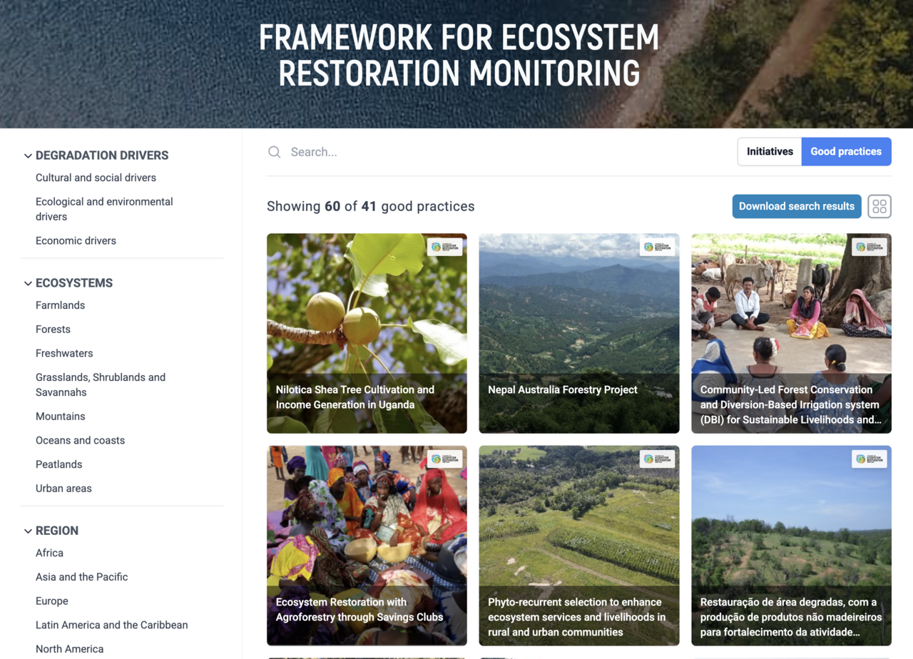
The FERM Common Search Engine for Good Practices
The FERM (Framework for Ecosystem Restoration Monitoring) Common Search Engine is a digital tool developed by the Food and Agriculture Organization (FAO) that allows users to find and share good practices in ecosystem restoration. It consolidates restoration practices from four collaborative platforms: the FERM Registry, LIFE GoProFor, Panorama Solutions and WOCAT. The search engine helps promote these practices, prevents mistakes, encourages learning and tracks restoration progress as part of the UN Decade on Ecosystem Restoration.